


Springville 2 Voting District, Utah County, Utah
About
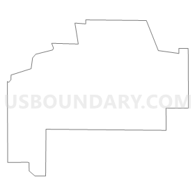
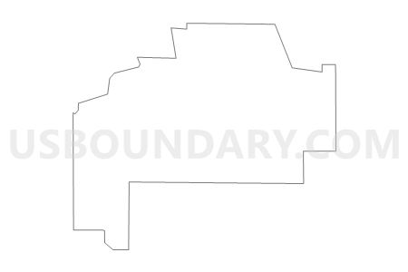
Outline
Summary
| Unique Area Identifier | 680196 |
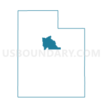
| Name | Springville 2 Voting District |
| County | Utah County |
| State | Utah |
| Area (square miles) | 5.04 |
| Land Area (square miles) | 5.04 |
| Water Area (square miles) | 0.00 |
| % of Land Area | 99.99 |
| % of Water Area | 0.01 |
| Latitude of the Internal Point | 40.17719130 |
| Longtitude of the Internal Point | -111.64274960 |
Maps


Graphs
Select a template below for downloading or customizing gragh for Springville 2 Voting District, Utah County, Utah


Neighbors
Neighoring Voting District (by Name) Neighboring Voting District on the Map
- Provo 17 Voting District, Utah County, UT
- Provo 2 Voting District, Utah County, UT
- Provo 45 Voting District, Utah County, UT
- Spanish Fork 7 Voting District, Utah County, UT
- Springville 12 Voting District, Utah County, UT
- Springville 13 Voting District, Utah County, UT
- Springville 4 Voting District, Utah County, UT
- Springville 8 Voting District, Utah County, UT
- Utah Lake Voting District, Utah County, UT
Top 10 Neighboring County Subdivision (by Population) Neighboring County Subdivision on the Map
- Provo-Orem CCD, Utah County, UT (200,995)
- Spanish Fork-Payson CCD, Utah County, UT (73,527)
- Springville-Mapleton CCD, Utah County, UT (42,473)
Top 10 Neighboring Place (by Population) Neighboring Place on the Map
- Provo city, UT (112,488)
- Spanish Fork city, UT (34,691)
- Springville city, UT (29,466)
- Palmyra CDP, UT (491)
Top 10 Neighboring Unified School District (by Population) Neighboring Unified School District on the Map
- Alpine School District, UT (284,505)
- Nebo School District, UT (119,571)
- Provo School District, UT (112,488)
Top 10 Neighboring State Legislative District Lower Chamber (by Population) Neighboring State Legislative District Lower Chamber on the Map
Top 10 Neighboring State Legislative District Upper Chamber (by Population) Neighboring State Legislative District Upper Chamber on the Map
Top 10 Neighboring 111th Congressional District (by Population) Neighboring 111th Congressional District on the Map
Top 10 Neighboring Census Tract (by Population) Neighboring Census Tract on the Map
- Census Tract 29.01, Utah County, UT (5,071)
- Census Tract 101.13, Utah County, UT (4,725)
- Census Tract 30.01, Utah County, UT (4,165)
- Census Tract 29.02, Utah County, UT (3,616)
- Census Tract 22.07, Utah County, UT (3,604)
- Census Tract 28.01, Utah County, UT (3,584)
- Census Tract 105.03, Utah County, UT (2,913)
- Census Tract 28.02, Utah County, UT (1,446)